Bangalore Metro Map, Updated Namma Metro Routes, Timings, Fare Chart, Stations List & Expansion Plans 2025
- Introduction to Bangalore Metro Map
- Understanding Bangalore Metro Routes
- How to Read the Bangalore Metro Map
- Major Stations on Bangalore Metro Map
- Facilities at Namma Metro Stations
- Bangalore Metro Timings and Frequency
- Bangalore Metro Fares and Ticketing Information
- Connectivity with Other Transport Modes
- Nearby Attractions from Major Metro Stations
- Travel Tips for Namma Metro Users
- Safety and Cleanliness at Metro Stations
- Upcoming Metro Expansions
- Conclusion
- Bangalore Metro Map FAQs
Introduction to Bangalore Metro Map
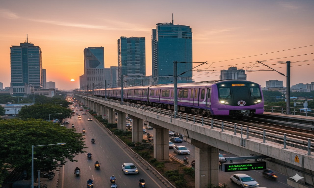
Metro Namma Metro formally known as Bangalore Metro is the backbone of the Bengaluru transport. It connects the key areas within the city and reduces commuting time to daily users.
Major ones included in the Map are Mg Road, Majestic, Whitefield, Yeshwanthpur, Jayanagar, and Electronic City. It operates under the Bangalore Metro Rail Corporation Limited (Bmrcl) that is continuously including more routes every year to make the city connected.
Understanding Bangalore Metro Routes
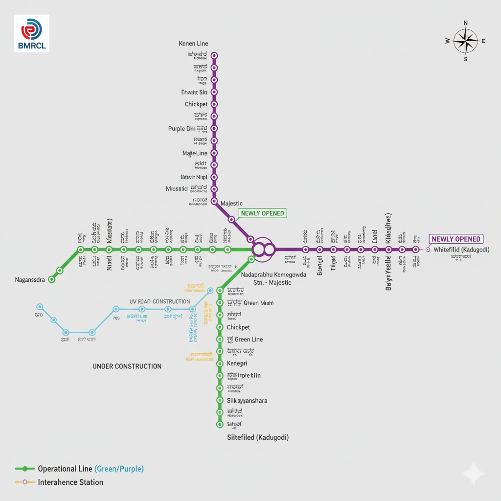
Namma Metro has various colour-coded lines that are depicted by different colours. These tracks assist the travellers in moving around the city.
Metro Lines Overview
Line Color | Route | Total Stations | Length (Approx.) |
Purple Line | Whitefield (Kadugodi) – Challaghatta | 37 | 43 km |
Green Line | Nagasandra – Silk Institute | 30 | 30 km |
Yellow Line | Rv Road – Bommasandra (Under construction) | 16 | 19 km |
Pink Line | Kalena Agrahara – Nagawara (Under construction) | 18 | 21 km |
All the lines have significant business, educational and residential centers and, therefore the routes are useful in everyday business transportation.
How to Read the Bangalore Metro Map
The Map is simple and clear. Every line is marked with color and change points at major intersection points.
- Purple and Green Line Interchange: The major interchange station is Nadaprabhu Kempegowda Station (Majestic) where interchange is possible.
- Prospects: When the Yellow and Pink Line come into completion, they will going to connect South and North Bengaluru without going roundabout.
- Map Accessibility: Digital and printed maps are also posted in the stations and on the Bmrcl website.
Major Stations on Bangalore Metro Map
The Namma Metro Stations are innovative with user friendly navigation. Here are the most used ones:
- Majestic (Kempegowda): Bus Change at Purple and Green Lines.
- Mg Road: Business roads, shopping, cafes.
- Baiyappanahalli: This is one of the oldest terminals which are now connected with Whitefield.
- Yeshwanthpur: This is connected to the railroad station and the industry.
- Jp Nagar and Jayanagar: Commercial and residential areas where there is the high traffic of passengers.
- Whitefield (Kadugodi): Tech hub comprising of numerous tech parks and offices.
Facilities at Namma Metro Stations
All of the stations have a number of passenger-friendly facilities:
- Smart Card System: Refillable cards to fast, hassles free travel.
- Token Counters: Tokens stocked in all stations that are single-journey.
- Elevators and Escalators: fitted in all large stations.
- Toilets and payment machines: neatly placed and hygienic.
- Parking: Two-wheeler and four-wheeler parks at a lot of stations.
- Security: Cctv and baggage scanners and metal detectors.
Bangalore Metro Timings and Frequency
Timings are easy on the workers and the tourists:
- Operating Hours: 5:00 Am to 11:00 Pm.
- Frequency: 5 -10 minutes during peak hours and 10 -15 minutes otherwise.
- Travel Time: The round trip duration on the Purple Line is approximately 80 -90 minutes.
Live services can be accessed via the Bmrcl website or via other mobile applications such as Google Maps and the Namma Metro App.
Bangalore Metro Fares and Ticketing Information
Rates are distance-oriented and low fares:
Distance Range | Fare (Approx.) |
0–2 km | ₹10 |
2–5 km | ₹15 |
5–10 km | ₹25 |
10–15 km | ₹35 |
Above 15 km | ₹45–₹60 |
Smart Cards: 5 percent discount with every trip and time-saving.
Scan Qr Tickets: Namma Metro App Scan Qr coded entrance/exits.
Recharge Switches: web-based, branches, and applications like Paytm and PhonePe.
Connectivity with Other Transport Modes
Bangalore Metro Connectivity extends to several other transport systems in the city.
- Bmtc Buses: This major stations have access to metro, such as Majestic, Kr Market and Banashankari.
- Metro Connections: Yeswanthpur, Kr Puram and Bangalore City Junction are connected with metro.
- Airport Dir/Link: Future Airport Dir/Link: Future Airport Dir/Link, Airport Line is an extension line that will link Kempegowda International Airport and the city center.
- Cabs and Autos: Stations have special pickup areas that facilitate the last-mile.
Nearby Attractions from Major Metro Stations
Travel around these locations with assistance of Metro Map:
- Mg Road Station: Cubbon Park, Brigade road, Church street.
- Lalbagh Station: Local food and Lalbagh Botanical Garden.
- Majestic Station: Gandhi Nagar Market and Freedom Park.
- Yeshwanthpur Station: ORion Mall and Iskin Temple.
- Whitefield Station: Phoenix market city mall and Itpl.
Travel Tips for Namma Metro Users
By taking these tips into account you can make your commute easier:
- Traffic: avoid the Morning time-list during 9:00 Am to 6:00 Pm.
- Use a Smart Card: It is quicker to purchase a token than it is to buy an actual one.
- Prepare, Prepare Put tokens in your pocket.
- Specifications: Legion It should stand in a ways on the yellow line; passengers should leave first.
- Check Last Train Timings: A vital point of attention to the late-night travelers.
Safety and Cleanliness at Metro Stations
Namma Metro Stations are known for their cleanliness and high safety standards.
- Cctv Surveillance: All platforms and trains are under surveillance.
- Clean Platforms: Metro maintenance.
- Safety of Women: Special security and separate compartments in time of high traffic.
- Emergency Help Desks: EHDs are located in all the stations.
Upcoming Metro Expansions
The Map continues to expand to include new routes:
- Yellow Line: This will be joining Rv Road to Bommasandra and improve the way to Electronic City.
- Pink Line: This is a connecting road between serve Nagawara to Kalena Agragara passing by Mg Road.
- Airport Line (Blue Line): The airport Line is to be linked to the city with Kempegowda International Airport by 2026.
- Phase 3 Projects: Aiming at Hebbal, Marathahalli and Jp Nagar.
These expansions will result in making Namma Metro to be one of the largest urban rail network in India.
Conclusion
Bangalore Metro Map is not just a route but it is a modern eco-efficient and efficient means of travelling around the city. Offering cheap rates, quick connectivity, new routes in sight and Namma Metro is, nevertheless, changing everyday commuting in Bengaluru.
Metro is the most intelligent and comfortable mode of travelling within the Garden City irrespective of whether one is an office-goer, a student, or a tourist.